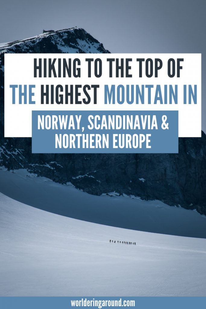
Galdhøpiggen, the highest mountain in Norway, Scandinavia, and Northern Europe is on many travelers’ bucket list. Finally, I managed to get there too! In this post, I share with you the details about the Galdhøpiggen hike, crossing the Galdhøpiggen glacier, and the best routes to get to Norway’s highest mountain.
Norway highest mountain – Galdhøpiggen height
Measuring 2469 meters, Galdhøpiggen (from Norwegian: “galdhø-peak”) is not only the highest peak in Norway, but also the highest mountain in Scandinavia and the whole of Northern Europe. That makes Galdhopiggen a desirable mountain for many eager hikers. If you approach it correctly, it’s not even that difficult (but preparation is needed – have a look below!)
Galdhopiggen location
Galdhøpiggen is located in Jotunheimen National Park (“park of giants” in Norwegian), in Lom municipality in Innlandet county in southern Norway. It’s one of the most popular Norway mountains, and one of the top hikes in Norway, just next to Trolltunga, Kjeragbolten, Romsdalseggen or Preikestolen.
And I recommend you to add it to your list, depsite the fact that it’s the highest peak in the country, it also provides spectacular views to the whole Jotunheimen mountain range.

Read more: 30 Best Hikes In Norway You Need To Try
Galdhøpiggen difficulty
Despite the fact that Galdhøpiggen is the highest mountain in Norway, it’s not that difficult to hike to the summit.
There are two main routes to do so.
One is easier and shorter, where you cut some time by crossing the glacier. Another one is longer, not technically difficult, and it doesn’t involve glacier crossing. Both are doable for generally physically fit people. More about the Galdhøpiggen hiking trails below.
Hiking Galdhøpiggen trails
Getting to the top of Galdhøpiggen, for it being the highest point in Norway, is not especially hard. There are two main hiking trails to Galdhøpiggen – check them below.

#1 Hiking Galdhøpiggen from Juvasshytta and the map
Start and endpoint: Juvasshytta
Total distance: 12km
Total time: 7 hours with a guided tour (including longer breaks), shorter if you’re going alone
Highest point: 2469 m Galdhøpiggen top
Lowest point: 1850 m Juvasshytta
Elevation gain: 619 m
Path: Marked path
Difficulty: Moderate to Challenging
Season: Guided tours are daily from 1st June till September
Cost of a guided tour (as for 2025): 480 NOK per person
Toll road to Juvashytta: 125 nok for passenger car
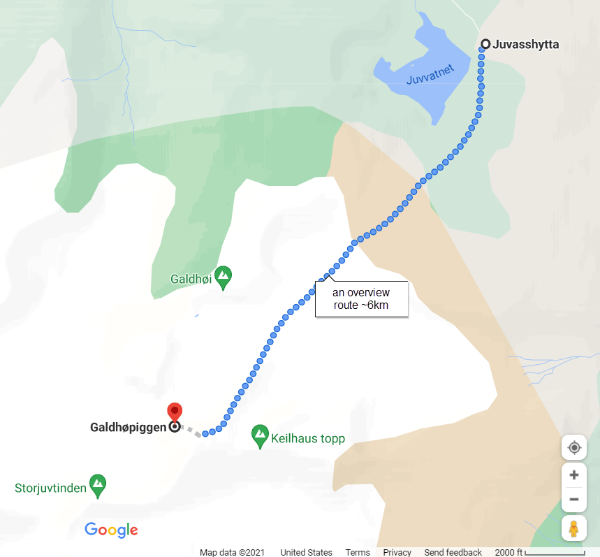
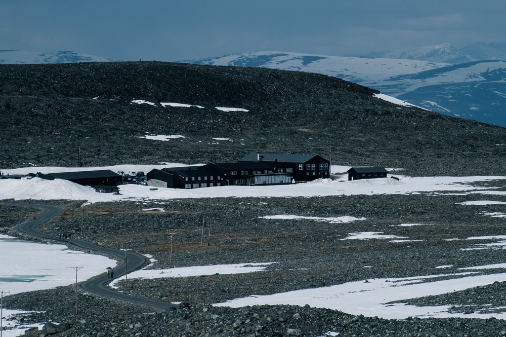
The easiest access to the peak is from Juvasshytta – a cabin in the mountains located at an elevation of 1850 meters. This route involves crossing the Styggebreen glacier, and hence requires a guide if you don’t have experience with glacier walking. They organize daily trips to Galdhøpiggen from 31st of May until the 14th of September (weather dependent). For the tour to run, they need minimum of 5 people, and it’s recommended to book online in advance. The tour usually starts at 10am.
This is also the route we took. More about our experience with it later in the post.
#2 Hiking Galdhøpiggen from Spiterstulen
Another option is to hike Galdhøpiggen from Spiterstulen cabin in Visdalen.
The popular hiking route from Spiterstulen to Galdhøpiggen is technically not demanding but it’s much longer and steeper, with a vertical elevation difference of 1,300 meters. This route doesn’t cross the glacier so a guide is not needed. There are two other, more difficult routes from Spiterstulen, too. The routes include a few other 2000-meters peaks in one trip as well.
Read more: Romsdalseggen – the most beautiful hike in Norway
Summiting the highest mountain in Norway – my experience
After almost 4 years spent in Norway and countless hikes, I finally decided to scale up the highest mountain in Scandinavia. After sharing the idea with some friends, we gathered a group of 8 and decided to hike together. Since none of us had experience with glacier crossing and some of us didn’t hike much before, we decided to go for a guided tour.
The trip started at 10 am from Juvasshytta, preceded by the safety briefing by the guides, together with the distribution of harnesses for glacier crossing. There was also English translation for non-Norwegian speakers. The weather was great, and we were all eager to start the climb!
Galdhøpiggen hike from Juvasshytta – three stages
Stage 1 – walk to the glacier edge (less than 1 h)
The hike starts with a relatively flat walk through the stones and snow (at the beginning of June) to the edge of the glacier. This first stage is around 2km, and it should take less than an hour. After reaching the glacier, we took a break so the guides could prepare the ropes for everyone.

Stage 2 – glacier crossing (around 45 min)
Glacier on the hike to Galdhoppigen is called Styggebreen, which in Norwegian means “ugly glacier”. The problem with glaciers is that there are often cracks and crevasses opening in them, which in June can still be covered with snow. It can be very dangerous if you fall into one of the cracks. That’s why glacier crossing is done with everyone connected by ropes and guides leading the way.
After everyone clipped to the ropes, we went off to cross the glacier.
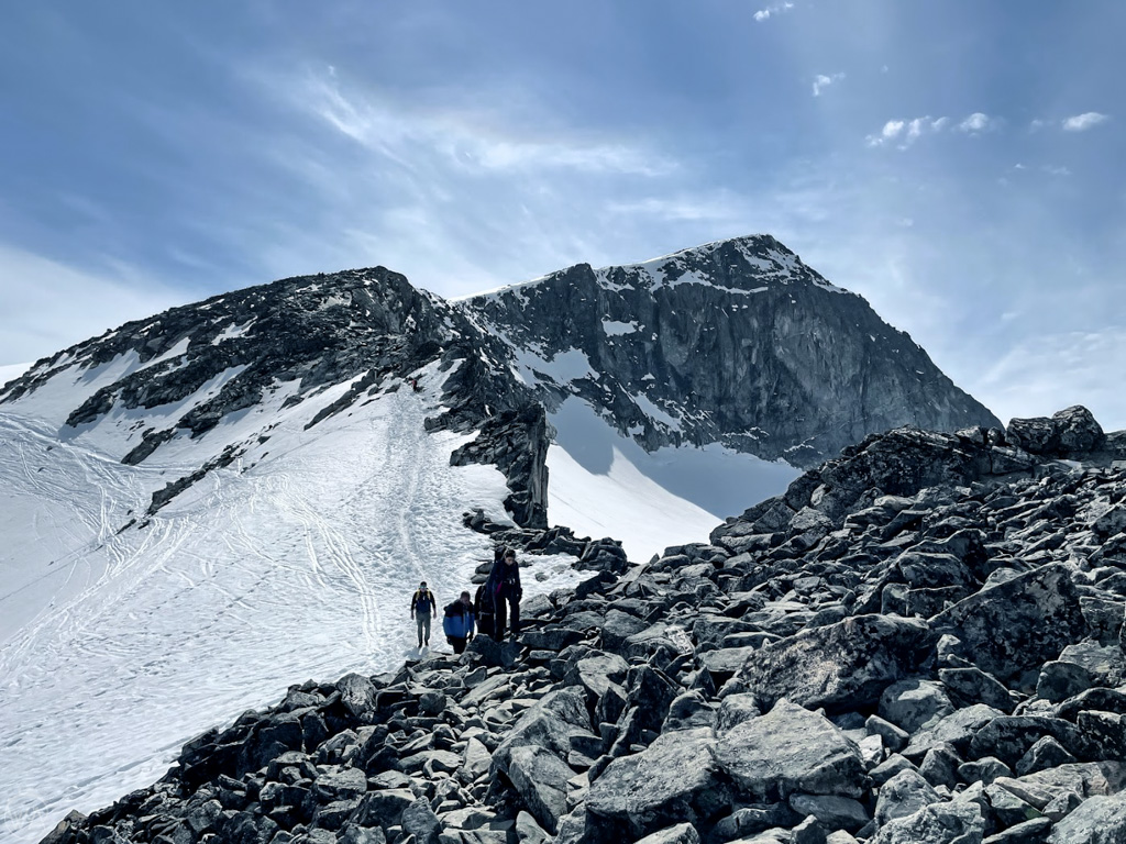
The crossing was mainly flat at the beginning, and then it gently rose until we reached a rocky area where we unclipped from the ropes.


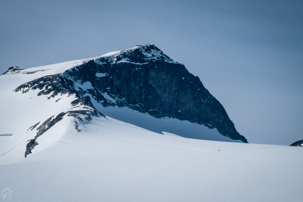
Stage 3 – the last leg to the top of the tallest mountain in Norway (around 45 min – 1 h)
The last stage of the Galdhøpiggen hike is the steepest one. This section also involves some scrambling and it is more exposed as you walk on big rocks along the cliff edge.
Read more: Kjeragbolten without crowds
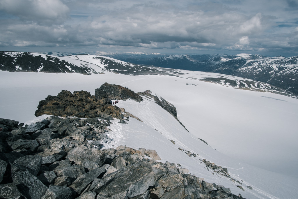
Galdhøpiggen – the highest mountain in Norway
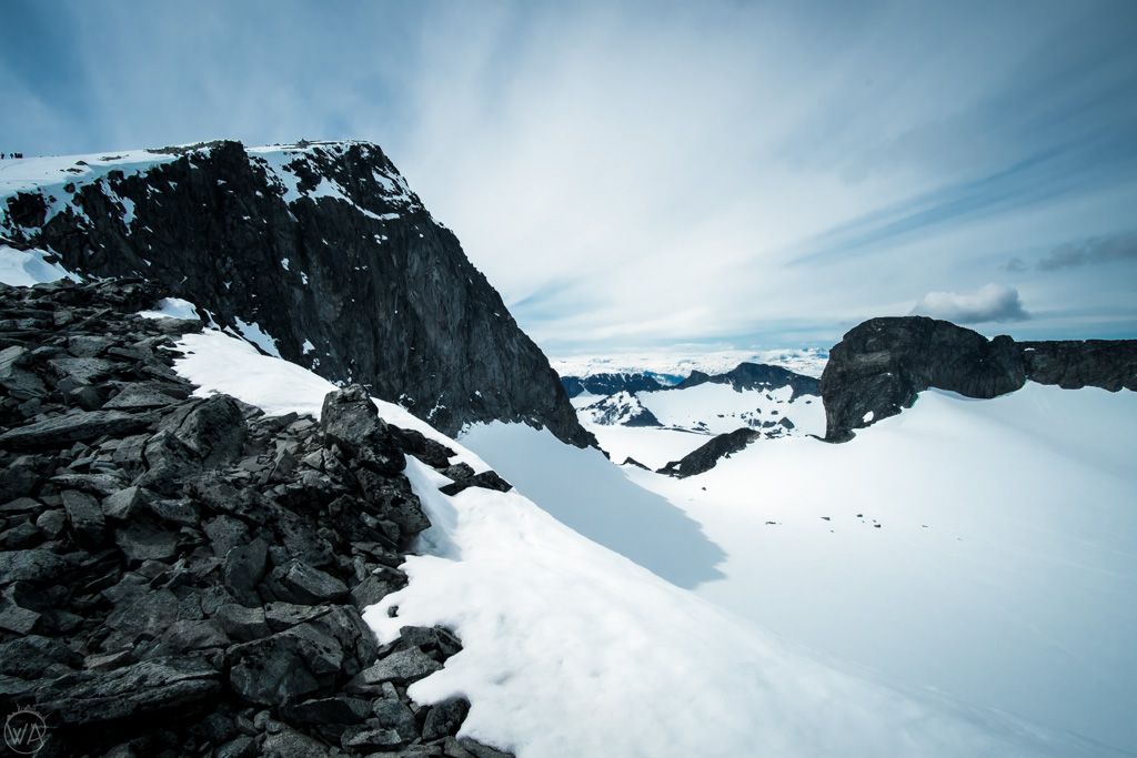
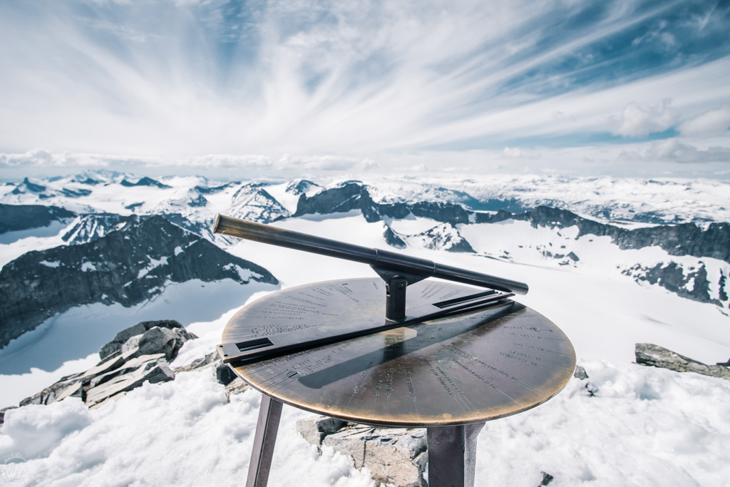
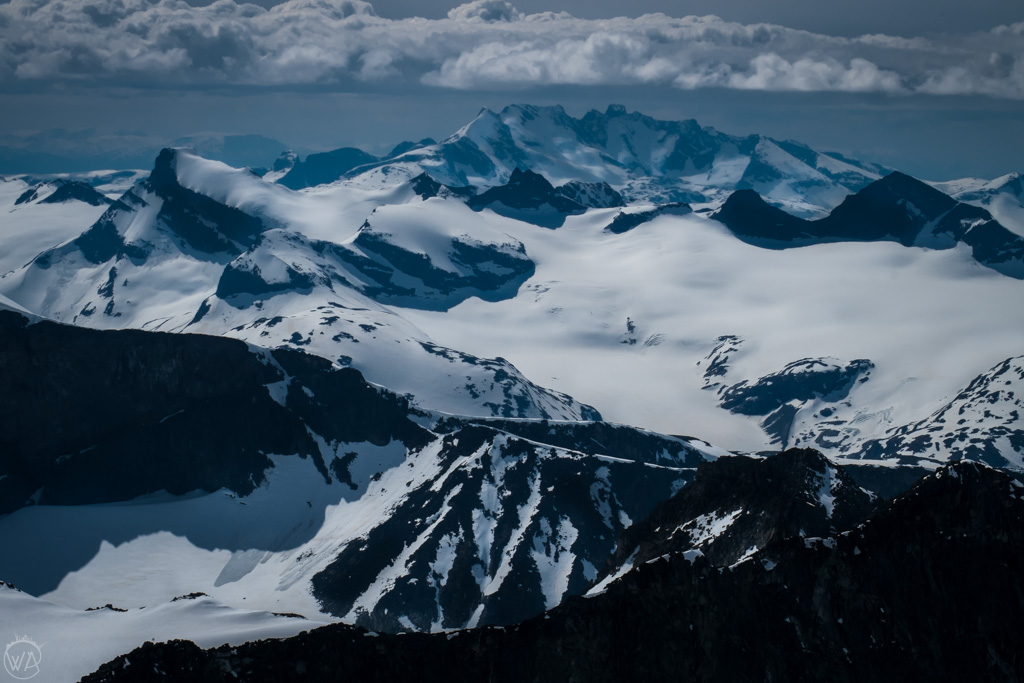
Once you reach the top of Galdhøpiggen, a breathtaking view of the whole Jotunheimen National Park opens in front of you. The sea of 2000-meters-high peaks is below you, and you really feel like you are standing on top of Norway.
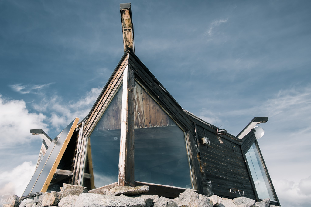
On the top, there’s a board with names of peaks around, and also a modern-looking cafe. It truly feels like Norway when on top of the highest mountain in the country, you can buy hot coffee and waffles while paying for it by card or Vipps (local mobile payment app).
The route down follows the same trail.


What to take for Galdhøpiggen hike
Some essentials to take to Galdhøpiggen hike include:
– Hat (warm hat and sun cap)
– Thin gloves
– At least 2 l of water
– Energy snacks and food for the day
– Hiking clothes – top merino wool baselayer and the bottom merino wool base layer, mid-layer and waterproof jacket and waterproof pants
– Backpack
At the beginning and end of the season (like for example in June) add:
– Gaiters – to prevent snow from falling into your shoes
Harness and crampons (if needed) are provided by the guides.
Where to stay when hiking Galdhøpiggen
The clostest town to Galdhøpiggen hike is Lom. Here, you will find a variety of accommodation, shops, and restaurants. Here are some suggestions:
- Røisheim Hotel & Skysstasjon – top recommendation for accommodation near Galdhøpiggen. This former farm has charming individually designed rooms with private bathrooms in a historic building dating back to 1700. It’s very popular and often fully booked, so book in advance. Check prices and availability here.
- Fossheim Hotel Lom – historic hotel with a traditional and ambient feel. The building dates back to 1897 and offers private rooms with bathrooms. Check prices and availability here.
Both cabins where the hiking routes start from, also offer basic accommodation – Juvasshytta and Spiterstulen.
Galdhøpiggen facts
- The highest mountain in Norway
- Height of 2469 meters
- The highest mountain in Scandinavia
- First ascent 1850
- The highest mountain in Northern Europe
- Accessible to the average hiker
- Located around 5 hours drive from Oslo, 6 hours drive from Bergen
Read more about Norway:
30 Best Hikes In Norway Explained + Map
Tips on how to travel Norway on a budget
Kjerag hike without the crowds – Kjeragbolten
Best Norwegian gifts and souvenirs to bring back from your trip
Would you like to hike Galdhopiggen and conquer the tallest mountain in Norway? Or maybe you already did? Let me know in the comments!
Like it? Pin it!
Hi I will be in Oslo 21/6/22 – 24/6/22
And want to take a quick trip to hike Galdhøpiggen. I would like to leave Oslo in the afternoon, sleep close by the mountain hike early in the morning and return to Oslo that evening. Can you suggest a guide or tour? Thanks
Hi Sean, you can join a tour from Juvasshytta, here is the info https://juvasshytta.no/galdhopiggen
Hi!
Thanks for the detailled article, very useful.
I want to do this hike in september. Is is possibile to do it without a guide ? I mean, is the glacier very dangerous without equipment? I don’t have harnesses or ropes, is it safe to walk on it ?
Thanks for your answer and sorry for my bad english !
Hi,
It is recommended with a guide due to possible cracks in the glacier. If you want to go without the guide or equipment, you can take another route that I mention in my post that doesn’t go through the glacier.
Good luck!
Aga
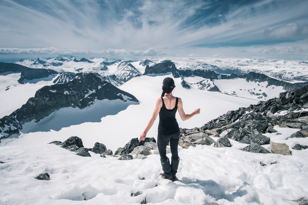
Great article, explained the peak and its approach well. But was that you in the half-naked insta-shot? It looked ridiculous…completely inadvisable dress, just done for social media I guess. Encourages dangerous recklessness… lot of people are now dead trying to get their ‘unique’ (ie. not unique at all) photos in these kinds of places. Don’t encourage it: there are enough dead tourists who died for a social media shot as it is!
Hi, I approved this comment, even though it’s not very respectfully written. But the “half-naked insta shot” I guess you mean the one when I’m in a sport tank top? It had nothing to do with Insta – I felt quite hot on the top, so this is how I was walking up there after hiking. I don’t think wearing hiking shoes, hiking trousers and a sport top is encouraging any dangerous behaviors – we all need to dress accordingly to the weather. And despite the snow, sometimes it does get quite warm in the mountains in the sun, even in winter (although this was already the summer time in Norway, so temperatures were much higher than they are in winter). Of course, I had other layers and put them on and off as applicable to the weather. Hope that explains :)
Enjoy your travels!
Nice reply Aga, you were very polite. Clearly you had the correct gear and fully roped up crossing the snow field. Having done quite a lot of winter walking and climbing in Scotland there have been occasions (albeit rarely) when I have been not dissimilarly dressed. The solar reflection off the snow can be very intense and it is important to maintain an even body temperature in such circumstances to avoid stressing ones body. The regular process of removing and replacing clothing is part of hill walking.
Excellent article and the really liked the photos.
Thanks, David, I appreciate your comment! I’ve done a fair amount of hill walking in Scotland as well – it’s so beautiful, but usually more windy/rainy. Or maybe I was just going out despite the weather ;) Because in the sunny days then there were midges, haha. Have a great day!